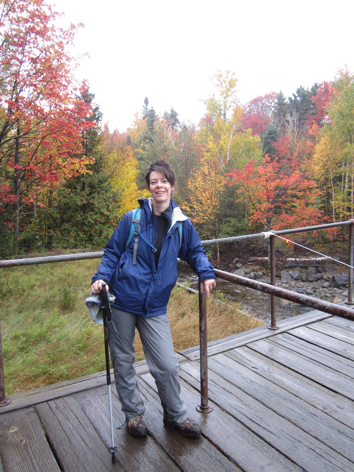
For the past year and a half, I've been going down to the Adirondacks with a friend of mine, and we've been climbing various
46ers. She had heard about the
46er club, told me about it as we climbed Mount Cascade and Mount Porter (see post about that
here), and ever since...we've been working towards the goal of joining.
I really should have been keeping this updated on those hikes, for others who have the same goal. I've been lax, what with my giant Africa trip, and then various little trips afterwards. So I'll post a short summary of the ones we've done so far, excluding Cascade and Porter because I've hit those two.
Algonquin, Iroquois and Wright
Order in ranking: numbers 2, 8, and 16
Last year, we summitted Mounts Algonquin, Iroquois and Wright (on one day), and then Giant Mountain the next.
Our original plan was to hike (or as we call it, mountain-hike) Algonquin and Wright, as they share a path, with Wright a junction off of the main path up Algonquin. But as we suited up at the car, a guide with the
ADK offered us some advice: climb Iroquois as well. It turns out that to get to Iroquois, you first must summit not only Algonquin, but also Boundary Mountain, between two.
This was one of our first lessons on attempting to call the 46 High Peaks: do your research before you go.
 |
| With the Peak Steward |
Algonquin is a nice climb, although there is a lot of sheer rock face at the end, and a few false summits. We actually yelled out to the Peak Steward "Is this really the summit?!?" by the time we got there. It's a little windy on the summit, so bring something to cut the wind.
 |
| Follow the cairns |
Iroquois is a trailless peak, but all that means in this case is that the trail is not marked, and it's not officially maintained. There is a herd path that you can easily follow; and down the side of Algonquin and up Boundary there are cairns marking the way - they're very easy to see and follow. Once you get to Boundary, there's a small sign pointing the way to an official DEC path, and scratched into the sign is a arrow with the word "Iroquois." (In case the scratched note is gone, you want to go in the opposite direction of the official path). From there, you follow a path through the trees towards Iroquois. The last bit is a mad scramble up a massive rock, to the summit of Iroquois. I'm afraid of heights, and this scramble up did trigger that, so be forewarned.
 |
| Atop the rock to the summit |
 |
| This rain cloud followed us all day |
Back down we scrambled, after a very short stay - it looked like rain, and we didn't want to be caught out in the open on any of the peaks so far. They're all (Algonquin, Boundary and Iroquois) open summits, with no trees for shelter. We high-tailed it back to Algonquin at a pretty good clip, and stopped to enjoy the view from there one more time. Then it was back down, to the junction with Wright.
We wheezed our way up Wright, and got caught by more false summits than I care to admit. I think if we had saved Wright for another day, we could have been faster, but as it was we were exhausted. We did make it to the summit, but not until after a lot of pep talks to ourselves. We didn't even attempt to find the bronze plaque that commemorates the bomber that crashed there in 1962, we just too tired.
 |
| No, I'm done for the day. Nap time. |
Total hiking time: 9 hours and 33 minutes
Left Adirondack Loj at 9:20, returned at 6:53
Summited Algonquin at 12:32, Iroquois at 12:46, and Wright at 4:09
Giant Mountain
Order in ranking: number 12
We weren't up as early as we had wanted to be the day after, but in all fairness, we deserved a bit of a lie in. We still made good time, though, as we got ready for another day of mountain-walking.
We had decided to climb Giant Mountain from the Roaring Brook trailhead, off of Hwy 73. This is opposite to the trailhead for Nippletop, Dial, Colvin, Blake, and Lower Wolfjaw, if you intend to do it alone, and not as part of a loop with Armstrong, Gothics and Upper Wolfjaw.
This was a very pretty climb, with incredible views the entire way, and a moderate incline at the beginning. Towards the end, it gets fairly steep, or so it felt to us. There's a marker that announces it's only .7 mile to the summit of Giant, but that .7 mile felt like the longest .7 mile in the existence of history.
 |
| On the summit of Giant |
The route was moderate in popularity - we saw a few other hikers, and met people at the summit, but often as not we had the path to ourselves. This was a welcome relief after the day before, when we saw a lot of people out on the paths around the Adirondack Loj.
Seeing as it was so quiet, we actually did get to see some wildlife - a small snake was sunning himself beside the path on our way back down to the trailhead.
Total hiking time: 6 hours 14 minutes
Left the trailhead at 10:05, returned at 4:19
Summited at 1:18
Tabletop Mountain
Order in ranking: number 18
Later on in the fall, we had a plan to go down for a weekend, and climb Tabletop and Phelps Mountains (they share a trail, until a junction for Phelps) on one day, and Street and Nye (again, they share a trail) on the other.
But wouldn't you know it - it started to rain, as we pulled onto the road to get to the Adirondack Loj, where we were to camp. We remained optimistic, as it was only a light drizzle, and set up our tent. We went to sleep, hoping that the rain would abate before morning. Our luck wasn't with us, and we awoke to full rain in the morning. Still, we persevered, and got ready to tackle Tabletop and Phelps.
 |
| Wet start |
We were late starting, as we had to register at the Loj, and get a few things together. We started off, and immediately had problems. It was wet, the trail was met and muddy, and it was slow going. We pushed on, and tried to remain optimistic. We staggered and pushed our way through the mud and trees, and finally got to the Tabletop junction.
Tabletop is an trailless peak, although the herd-path that you take to the summit is maintained somewhat. It's easy to follow, for the simple reason that it's actually a streambed you're following. And in the rain.....it's a stream. You have to walk up and through the stream to get to the summit. To compound our problems, because it's a trailless peak, the herd path is very narrow, with lots of trees (with their roots and branches) in your way. My waterproof pants ended up ripped at the bottom from getting snagged one too many times.
 |
| We made it! Finally! |
We finally did reach the summit, but we were so worn out and tired, not to mention cranky and cold, that we didn't stay long. It was long enough, though, for us to realize that we had least picked a good day to climb Tabletop - it's a treed summit, so there's no view. We were happy not to have wasted a nice day with a summit that had no view.
We started to stagger our way down, still with the intention of climbing Phelps when disaster struck. I slipped on the rock, and started to slide down - thankfully, still on the path, but I'd have a nice bruise on my backside the next day. I picked myself up, swore, and continued on. We reached the junction, and pushed up on Phelps. We climbed for what seemed hours (actually, I think it was 2) and came to the realization that it was too late - we weren't going to summit Phelps that day.
 |
| Spirit still high, on the way up |
This was our second lesson of hiking the 46ers: Be prepared to turn around.
And our third: Plan for all eventualities; plan to hike two mountains, expect to only summit one.
We turned around, and started down, when disaster struck again. Steph caught her foot in a root, and fell. Hard. She thankfully didn't break anything, but her leg was given a nasty jar, and she bruised (and possibly sprained) her thumb while catching herself on her fall. We were extremely lucky that neither one of us hit a jagged rock or tree root when we fell. We started back down at a slower pace, limping and in bad moods.
Total climbing time: unknown
Left Adirondack Loj at 9:45
Summited at 1:23
Phelps Mountain
Order in ranking: number 31
We had unfinished business with Phelps after our disastrous trip in mid-September. We decided that we'd do the fool-hardy thing, and drive down from Ottawa early early (5 am early), climb Phelps, have some dinner at
Desperados (fantastic Mexican food, with many gluten-free and vegetarian options), then drive back home. It would make for a long day, but we were up for it.
 |
| Marcy Dam |
We got onto the trail at a reasonable hour, and blew through the first portion, to Marcy Dam. This is relatively flat terrain, and good for beginner hikers. It's very pretty, and the Dam makes a nice backdrop for lunch. We kept going, though, and quickly came to the Phelps junction.

Up we started. It didn't take much time for us to come to the realization that it had been a good thing to turn back last time. We were no where near the summit when we had turned around, and we probably wouldn't have made it back to the Loj before the sun set.
We kept going, and eventually reached the summit. Phelps isn't a difficult climb, and if it hadn't been for the rain on our first trip, we would have summited it with no problems. Reaching the summit, we were both glad that we had summitted on a better day, the view of the surround area was incredibly. The nicer weather was definitely a boon, to actually get to take advantage of the view!
On the way down, we actually managed to find the root that had tripped Steph on our first attempt. Considering everything looks the same after a bit (it was a root, on the trail, near a tree - very vague statement when everything is a root on the trail near a tree). It was one of the few areas on the trail that didn't have a million jagged rocks that she could have fallen on. Seeing it again, in the clear light of a sunny day, we thanked whoever had been looking out for us. It really could have been a lot worse.
Total climbing time: 5 hours 49 minutes
Left Adirondack Loj at 10:20, returned at 4:09
Summited at 2:09
Lower Wolfjaw Mountain
Order in ranking: number 29
 |
| Misty Mountains |
While I was in Africa, Steph took a few trips down to climb some of the other 46ers, Lower Wolfjaw and Big Slide. While I still haven't had a change to climb Big Slide, and I did go down over the Thanksgiving (Canadian Thanksgiving) weekend to climb Lower Wolfjaw. It was another somewhat wet climb - it drizzled on and off during the morning, but the rain cleared up in the afternoon, although it took a little longer for the clouds to dissipate.
The BF and I did this as a day trip, so we didn't get started until a little later, just after 10:00. We were accessing the WA White trailhead on the AMR property, so we took a short jaunt up the road to the clubhouse (faaaaaancy), and turned left at the tennis court. We quickly came to the trailhead and signed in.
 |
| Beautiful trees |
The first part of the hike is incredibly beautiful, as you hike through birch stands. The trail begins to do a bit of a zig zag up the mountain, as you climb around a rock wall. It's not too steep, but it does add time to the climb. We came to a few junctions, and it was at the final one, 1.5 miles to the summit, that I left the BF behind. (It's not that I don't love him, but he's a computer geek. He's not in the greatest of shapes.)
I quickly picked up the pace and raced towards what I hoped was the summit. Every now and then I'd hit an open patch, and think "is this it??" And it never was. I finally met up with a group of people who said that the summit was a little further on. So I continued, and....found the path going down. I figured I had hit the summit, and returned. When I met up with them again (in the same spot, as they were taking a break) they informed me that the trail actually descends quite steeply first, then climbs steeply before you hit the summit.
So heaving a great sigh.....I turned back and continued through the steep bits (with lots of "Ok, how will I climb/descend
that???" thrown in for good measure). I finally did hit the summit, along with three other hikers who had come in from Upper Wolfjaw. They kindly took my photo, and I raced back, to find the BF.
 |
| Summit! |
Who just so happened to be at the steep upper part! He had made it that far, although his knee was starting to hurt, and it was getting late, so we decided we had better head back.
It was slow going on the way down, due to the BF's knee, and me totally forgetting that I had Advil in my pack. But we did make it, a little later than we had hoped, but back alive and in one piece.
Total climbing time: 8 hours 22 minutes
Left trailhead at 10:14, returned at 6:36
Summited at 2:09
Nippletop and Dial
Order in ranking: numbers 13 and 40
 |
| Seriously? It's the end of May |
Nippletop and Dial were our first climbs of the 2013 "climbing season" as we call it. We're fair weather hikers/campers - we firmly avoid the mountains in the winter months. We thought by the May long weekend, it would be warm enough, and nice enough, to venture up.
It was and it wasn't. We did encounter snow, although nothing that deep. There were the odd occasions where we wondered if we needed crampons, but in the end we were fine in just our hiking boots. It did pay to go carefully through the snow and ice, as occasionally the ice masqueraded as rock - all the dirt covering it was doing a good job at disguising it.
There are two possible ways to do the loop that we did - climb a steep, but non-treacherous path over the shoulder of Noonmark, over Dial, to Nippletop, and then descend over a very steep, rocky section, or the reverse. I've found, after climbing 9 High Peaks, that it's over easier to climb up the rocky section, rather than down. In essence, the rocky sections are where the mountain has fallen away/been pushed down by glaciers or water, so going up means you can see how the rocks fell. It's much easier to find footing when you can see how the rocks interplay, then to descend these rocks, and how that interplay hidden.

So we walked down the Lake Road to Elk Pass, and up over Nippletop. There are actually three or four steep bits, but the last steep bit is the
steep bit that guide books warn you about. It's not a bad hike though, and there's lots of waterfalls along the way, so no matter where you take a break, you get a view. The trail was incredibly wet as we wet along, and I'm not sure how much of that was due to the wet spring weather, and melting snow. Guide books mention that Nippletop is known for being wet (not weather-wise, trail-wise).
We met other hikers on the trail going to various peaks - Colvin, Blake, and Nippletop. It was nice having company, especially so early in the season. We reached what we thought was the summit of Nippletop when we realized.....it wasn't. The trail kept going. So we rounded a corner, and.....is that Nippletop? Way over there?!? We have to hike all the way over there?!? The true summit seems forever away, when in fact it's a quick 3 minute hop over. The distances can be very deceptive when you're looking over the range.
 |
| That looks really far away |
We had a half hour break on Nippletop, admiring the view, before we headed out to Dial. It's a great walk along the ridge line, to Dial. There is some gentle grade up and down, which is a nice break after the scramble up Nippletop. The summit for Dial comes up on you all of a sudden - it's a rocky outcropping from the trail. More great views here, so you have a choice of where to have lunch - both summits afford a good look at many 46ers.
 |
| Hanging out over Nippletop |
 |
| Dial summit |
After Dial, we continued over Bear Den (it's a treed summit, so good luck figuring out where it is. Also, no we didn't see a Bear Den.) and down. Well, down and then up, as the trail climbs over Noonmark's shoulder, before descending back down to the Lake Road. The last bit is quite steep, but there aren't any rocks. It's hard on the hips and knees, but there's no scrambling.
Total climbing time:9 hours 15 minutes
Left St. Hubert's parking lot at 7:18, returned at 4:33
Summited Nippletop at 10:40, Dial at 1:40
Whiteface and Esther
Order in ranking: numbers 5 and 27
We were up nice and early the next day, and drove the short distance to Whiteface mountain. The parking lot for the trailhead is minuscule - about enough room for 2 cars. It's easy to drive right past it, but you don't get far before realizing you're past it.
 |
| Can't miss the cairn |
We were entering from the Wilmington trailhead, mostly because we wanted to climb Mt. Esther as well. The first part of the hike was great - fairly flat, with moderate inclines/declines, through trees and few to no rocks. But we quickly hit the steep portions, as we started climbing higher to the almost summit of Marble Mt. It's a steady incline, somewhat steep, that will have you asking when the next flat bit will come along.
From there, we pushed on up towards the junction with Esther. Again, it's a steady, moderately steep, incline to the cairn that marks the junction. The guide books call it "small" but it certainly isn't - you can't miss it. Esther is another trailless peak, but again, the herd path is moderately maintained and easy to follow.

The climb to Esther is easy, once you get past the first 100 yards or so, which are steep. After that it's a gentle up and down grade, as you wind through the trees. You almost feel like you are circling the summit as you come up to, and then it opens up and you get a great view of Whiteface. There's a small plaque on the summit, for Esther McComb who made the first ascent.
We paused for a moment, but other than the view of Whiteface, Esther doesn't provide much. So we hustled back down, meeting a few other climbers on their way up.
We got back to the junction and paused for a food break. I think we were hungrier on day two, after expending so much energy the day before! Thankfully we had packed a lot of munching food for our climb.
 |
| You skirt this wall, you don't climb it |
We headed up Whiteface, which at first was an easy, if somewhat wet, climb. There were a lot of downed trees along our route - clean up crews hadn't been by to clear the trail, yet - so we had some manoeuvring to get over them. We came upon a old ski lift area (or perhaps it's a ski run) and stopped to have some more food. After that, it was steeply up as we followed old ski lines. We went up up up, and then up some, over snow and ice at some points. The trail was slick in places, especially as we came up over the rock scramble to the road, and wall surrounding it.
The rock scramble was fun going on, somewhat treacherous going down, as you couldn't see what was hidden by the rocks on the other side, as you could when you were going up. The boost to get up to the path above the road was wet and slick, so we took our time. After that, it was a moderate grade incline - not as steep as it had been, but certainly not as gentle as Esther had been. We followed the paint blazes on the rocks, as we had hit the Alpine zone at this point. There's a wonderful open area just below the summit, where you get great views of the surrounding countryside, and without all the other people like you do at the summit. If the weather had been better (by this point, clouds had blown in) we might have stayed for a bit. As it was, we pushed on.
 |
| Just beyond that wall is a highway |
We staggered up to the summit, and had our picture taken with the sign. All the tourist who drove up kindly let us go first. We popped into the building at the top to warm up a little (Whiteface is always windy, but today it was freezing at the top), and regroup.
If you do climb Whiteface, don't forget your wallet. There's a cafe at the top where you can grab food or water. We both forgot ours, which led to our fourth lessons of climbing in the Adirondacks:
Always care money in backpack. You never know when you might need it.
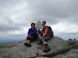 |
| Made it! |
We left the peak, and began the descent. We were so focused on our conversation, that we both missed the open area where we had had our lunch. Just towards the end of the hike, it started to rain, and we were very glad to have missed the rain at the summit. The tree cover kept the rain mostly off us, so we didn't bother with pulling out our rain gear.
Total climbing time: 9 hours and 8 minutes
Left trailhead at 7:10, returned at 4:18
Summited Esther at 10:43, Whiteface at 12:55