So the BF and I decided to once again hit the skies and vacation in the south (Cuba) over Christmas and New Years. The way the holidays fell, and the flight pricing went, we left on December 21 and returned on January 11. So we planned to spend two weeks visiting Cuban cities, before we ended our trip with a week at an all-inclusive resort.
Let me just say - I had never (up until this trip) been to an all-inclusive resort. I never thought it was really my "thing". How would I entertain myself for a week in one spot? Lounging on the beach is great for a day or two, but....7 whole days of it? Yikes.
The timeline:
December 21 – 25 – Havana
December 26 – 29 – Baracoa
December 30 – 31 – Santiago
January 1 – 2 – Camaguey
January 2 – 3 – Trinidad
January 4 – 11 – Cayo Guillermo
Transport
 |
| Taxis in Havana |
We flew Westjet into Varadero – flights from Canada (we flew out of Montreal) are a lot cheaper to fly into a resort destination. We met a young couple from Belgium/France (heading to Trinidad) and shared a taxi (10CUC each) into Varadero City. We didn’t see (or couldn’t find) a shuttle bus going to Havana that we could buy a ride off. In Varadero, my boyfriend and I got a taxi to Havana for 80CUC.
From Havana we flew to Baracoa. We booked our tickets via Cubajet.com – we never did get our e-tickets, or a confirmation email, but we called them once we were in Havana (have patience, it can take a while to get through) and confirmed we were on the flight. The flight itself was quick and easy – it was a twin propeller plane (for Canadians, think Porter), and took about 1.5 – 2 hours.
Baracoa – Santiago, we used Viazul. We booked tickets through the Transgaviota office in Baracoa (no commission fee) the day before. The bus was half empty, so we had lots of room to spread out. It took about 5 hours, and departed/arrived on schedule.
Santiago – Camaguey, we used Viazul again. This time we booked tickets through the Havanatur office in Cespedes Square, and paid a 2CUC (total) commission fee. The ride was longer, taking about 7.5 hours, and again it departed/arrived on schedule.
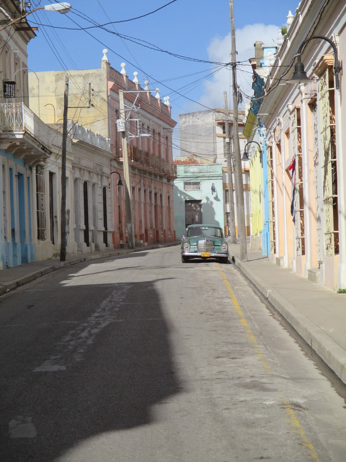 |
| Street in Camaguey |
Camaguey – Trinidad, we hired a taxi. Initially we were quoted a price of 150CUC, but settled on 135CUC. We probably could have gotten a lower price. We ended up in a well-taken care of Lada (with good shocks) – it took us 3.5 hours, and the driver helped us find a casa in Trinidad.
Trinidad – Cayo Guillermo, we hired a taxi again (the husband of our casa owner) and paid 130CUC for the ride, taking about 4 hours.
From Cayo Guillermo, we took a airline shuttle bus (10CUC each) to the airport at Cayo Coco and flew to Toronto.
Lodging
The
first night we were booked into a high-end hotel. While it was ok, it
felt a little remote from "the real Cuba" - it was basically the city
equivalent of the beach resorts. It didn't help that it was 6km west of the city centre in Miramar. However, it was just for the one night, and the next day we headed into Havana Vieja to the casa particular that we had booked.
After that we stayed in casas the entire way. We pre-booked our Havana casa via havanacasaparticular.com, which we found recommended on LonelyPlanet's ThornTree. Our reservation wasn’t passed on to the owner, though, so she had no idea we were arriving (and had rented out the room.) Lesson: Always call in advance! She helped us find another casa in the neighbourhood, only three blocks away. We paid 30CUC/night plus 5CUC for breakfast. The casa was new, clean, and had an air conditioner, ensuite bathroom, sheets, towels and soap.
We also pre-booked our Baracoa casa through mycasaparticular.com. We called and confirmed a few days in advance, and they had a taxi driver meet us at the airport. We paid 25CUC/night plus 4CUC for breakfast. The casa was incredible - there was a rooftop terrace, where we could sit back and relax, as well as another terrace on the second floor, this one offered a bit more shade and protection from the elements if it happened to be raining. This is also where we were served breakfast. Again, the room came equipped with an ensuite bathroom, sheets, towels (no soap), a/c and a fan. There was also a maid, who did our laundry for us.
 |
| Looking out at Baracoa |
Our Baracoa casa owner booked a Santiago casa for us, and again we were met at the Viazul station. We paid 25CUC a night, and 3CUC for breakfast. This casa was a little different - the bedroom and ensuite bathroom had at one point been one room, but it was partitioned, and a false ceiling installed in the bathroom. The partitioning wall had a "window" cut out up top, which looked out over the false ceiling in the bathroom. The original end wall (now the end wall of the bathroom) had a tiny window up top. The window cut out in the partitioning wall allowed our room some bit of sunlight during the day. Despite this, the room was very comfortable - it had been painted with an outdoors sea mural, making the room feel a bit more expansive.
 |
| Santiago near sunset |
We tried, in our stumbling Spanish, to see if our Santiago casa owner had a recommendation for a casa in Camaguey, but a miscommunication occurred, and we arrived with no casa booked. We relied on a bici-taxi driver to find us one – he tried two before he found one with a room available. Again we paid 25CUC a night, and 4CUC for breakfast. Like all the other casas, we had an ensuite bathroom, towels, sheets and a/c.
Our taxi driver from Camaguey found us a casa in Trinidad by knocking on doors. We ended up in a nice casa in the historical centre, for 25CUC a night and 5CUC for breakfast. As all the rest, we had to walk into the family home, but unlike most of them, rather than walk all the way through their house to our rooms at the back, we had a staircase right near the door that led up to area that had the private rooms for rent.
Only in Havana and Baracoa did the casa owners speak some English, the rest of the time it was strictly Spanish. All casas had towels, ensuite bathrooms and a/c, but only a couple had fans. Most also had water for sale.
Money
Definitely bring cash. We carried some with us, and hid some in our rooms. We didn't have a problem with pickpockets, but that's not to say that you shouldn't take precautions. Most places (restaurants, paladars, casas, etc.) don't take credit or debit cards. (It wasn't until we got to the resort that we actually used one.) If you do find you need some extra money, we did find working ATMs in Santiago and Trinidad. We saw one in Havana that wasn't working, but I'm sure there are others.
 |
| Street performs in a square in Havana |
Food
Cuban food gets somewhat of a bad rap. If you've travelled in Central America, you'll be familiar with the "beans and rice" theme. You'll also be familiar with the "no seasoning" theme. We did find most meat to be over-cooked, and over-salted, but otherwise the food is very straight-forward. A little bland, but certainly not bad.
While we don’t have any food allergies, I don’t eat seafood or eggs, which wasn’t hard to deal with in Cuba, although breakfast was usually fruit, bread and eggs, with the occasional side of ham and cheese.
We ate mostly at paladars in Havana – when we decided we were hungry and it was time for lunch/dinner, we’d head out to the streets and were usually approached by someone with a menu. If the prices/options looked decent, we’d go to the restaurant and if that looked decent, we’d eat there.
In Baracoa and Trinidad we just wandered around until we found a paladar or restaurant that looked good. We ate the old fort in Baracoa – the food was good, and we were out of the eye of most jinteros. In Santiago we ate at the Gran Hotel – just for a change of pace. In Camaguey, we went to a few recommendations from LP – they turned out ok. We especially liked the Italian restaurant in Camaguey, but found the buffet served at the Gran Hotel a little over-priced. (It was 20CUC)
We ended up with food poisoning our third day in Havana – having said that, it can happen anywhere, even at restaurants at home. Bring some Imodium (or similar) from home, as well as some soft toilet paper!, and drink plenty of fluids if it happens to you.
 |
| Patio in Trinidad |
For people with gluten allergies – everything came with bread, however most meals were served without a sauce of any kind, making it easier to avoid gluten (i.e. meats were seasoned with onion and garlic, no sauce.) Still, small lunch spots tend to serve some variation on ham-and-cheese sandwiches so a bit more planning may be required.
For egg allergies – I had an easy time (mostly) of avoiding eggs, until I ordered a “club sandwich” at Sloppy Joe’s in Havana, and it came with an egg. Most breakfasts included eggs of some kind, but the phrase "no komo huevos" lets them know that you don't eat eggs. (However, they seemed to think I meant I didn't want eggs (no quiero huevos) so each morning they'd ask if I wanted eggs).
Fish was mostly easy to avoid, barring a few soups and rice that used a fish stock, however for vegetarians it may be harder. We didn’t get many vegetables on our trip (lots of fruit, fewer vegetables) and most rice had a faint pork flavour. The vegetable soups we ate also used a meat stock. Our resort had lots of vegetable options, however.
Jineteros (touts, hustlers, etc)
Having been to East Africa and some other countries in Latin America, we didn’t find Cuba to be too bad in terms of street touts. We used them to find paladars, but ultimately it was our decision to stay and eat or go. We did find them to be a bit of a hassle around Hotel Inglaterra – we were sitting on the patio having a drink and it was (at first) a non-stop barrage of people asking for money or trying to sell you things. We used the same technique we have elsewhere – we ignored them, unless they came right up to our table, at which point we said ‘Non, gracias’ and then ignored them. Havana was the worst; Trinidad, Baracoa and Camaguey we were hardly bothered.
If you’re doing a city tour from one of the resorts, you’re more likely to be targeted – we did, and that little plastic bracelet was like a magnet. Again, we were polite by firm and ended up being left alone.
Excursions
For the most part, we spent our time wandering around the different cities - no plan, no goal, other than to see and find what we could. This worked well in Havana (until we tried to do the LonelyPlanet walking tour, at which point we got thoroughly lost), Camaguey and Trinidad.
 |
| Farmer's hut in AvHNP |
In Baracoa, we booked a hike in the Alexander van Humboldt National Park, through Cubatur. We left around 9:00 a.m. and drove to the Park. From there, it's a 3 - 4 hour hike into the rain forest, passing a few small farms along the way. The guide stopped often to give us information the flora and fauna of the region, pointing out different birds, lizards, frogs/toads, flowers and trees. The going was slippery, especially once we hit the rain forest section, and most everyone ended up with some red mud caked to their pants, having slipped.
Just after 1:00, we came to a small clearing, beside a little pond/river and waterfall. We all changed into swimsuits, and took to the water. After the hike, it was wonderfully refreshing.
Which brings me to shoes. If you have a pair of Teva-like sandals (with straps over the foot, and around the ankle) they are by far the best type of footwear for this hike. There are quite a few river crossings, and if you're in boots/runners, you'll be forever taking them off/putting them on. Not to mention that at the waterfall, there were a lot of rocks to cross before getting to water deep enough to swim in. Towards the end of the hike, the BF and I decided to just tramp through the water with our shoes on. (This led to having to buy new shoes in Trinidad, because ours smelled so bad. They'd be stuck in a plastic bag for nearly a week, since we didn't have a balcony/terrace in Santiago or Camaguey to set them out in the sun.)
Souvenirs
Everything was a repeat. If you saw wooden toys in one city, you'd see them in every city. The only exception to this was artwork. We saw a lot of beautiful artwork in Havana, and even considered buying a small picture, but ultimately decided against it, as we were in the beginning of our trip. We never did find anything of remotely the same talent in the rest of Cuba.
The Resort
 |
| Ocean view from our room |
We chose to stay at Sol Cayo Guillermo. Cayo Guillermo, and Cayo Coco, are connected to the main island via a causeway. There are no Cubans that live on there - it's purely for tourists, and Cubans need to have a special permit to access the causeway. It is very much not "Cuba."
The resort was 4-star, but still very nice. Clean, comfortable and the staff were great. There were a lot of mosquitoes and other biting insects (I ended up with over 80 bites on my legs); the resort did fumigate nightly, but I'm not sure it helped.
I found the feeding schedule really restrictive - the snack bar was open from 11 a.m. to 6 p.m., but it served greasy, fried food - hamburgers, hot dogs, grilled sandwiches, chips, etc. And there was nothing available between when breakfast ended (10 a.m.) and when the snack bar opened. Which of course, is when I would get hungry. The buffet was wonderful - a huge array of food, and lots of options. There was also a huge salad bar - with lettuce! I was so excited to have a salad, after two weeks of no veggies.
 |
| White sand beach |
The beach had beautiful white sand, ruined by a lot of seaweed. I think it was just a bad time for seaweed, and they did try to keep it somewhat under control. The water was wonderfully warm, and very shallow for quite a ways out.
We did a few excursions from the resort - we took a trip to Moron and Ciego de Avila, which probably would have been better if we hadn't done Cuba on our own first. You're only given 30 - 45 minutes of "free time" in each city, and the "tour" they give you doesn't give you much of an idea of the cities themselves. However, the speed boat trip across a lake, and into a mangrove forest was incredible, and the crocodile farm was interesting, and interactive. For a fee, you can hold baby crocodiles and iguanas, and feed the adult crocs.
 |
| Ah, hugs! |
Our second excursion was to the dolphinarium on Cayo Guillermo. It was expensive, 110CUC each, but we got to swim with trained dolphins. We interacted with them on the dock for a bit, then jumped into the water. One by one, we got to go up and perform some tricks with the dolphins, before posing for pictures. Afterwards, we headed to Playa Pilar for lunch, and some relaxing time on the beach.
TL;DR version
Pros Cons
- Trinidad and Baracoa - Santiago and Havana (after 3 days)
- inexpensive destination - repetitive food and souvenirs
- Viazul buses north to south - Viazul buses south to north


