Saturday, 14 June 2014

The Dix Range and the Kindness of Strangers


Order in ranking: Macomb 21, South Dix 37, Grace Peak 42, Hough 23, Dix 6

Not three weeks after getting back from the ‘Dacks, Steph and I were back to climb as many of the High Peaks in the Dix Range as we could.  We were aiming for 5 (Macomb, South Dix, Grace Peak*, Hough and Dix itself) but would settle for four (all but Dix) if the weather, our legs, our stamina or the bugs didn’t cooperate.


The Dix range can be hiked from several points – You can access Dix from Round Pond (and originally we wanted to do a traverse starting from here), Grace from Route 73 (I want to find that trailhead, I’d love to do Grace Peak again), or from Elk Lake.  We decided on Elk Lake, and do a loop – up Macomb, to South Dix, and quick jaunt to Grace Peak and back, over to Hough, up Dix, and then down Hunter’s Pass.


We car camped at Elk Lake, and started off early in the morning – it wasn’t quite six when we signed in to the trail register.  We quickly hit the Slide brook lean-to – it only took us an hour to go the 2.3 miles.  We did briefly get lost once at the lean-to, so let me give you some helpful advice – when you see the first campsite sign, just prior to Slide brook, turn right, into the campsite.  That’s where the trail to Macomb is.  (For better instructions:  You will go over a wooden bridge, and soon after see the yellow campsite sign.  If you hit another bridge, you’ve gone too far- turn back!)  The Macomb trail is marked by a cairn.
View from the base of Macomb Slide
The trail to the Macomb slide is quite nice, although there were at least two sections of blowdown that you have to hike through.  You will see the slide off to your right through the trees as you approach it.  (Don’t worry about the gushing water of the brook – it slows to a trickle the closer you get – or at least it did when we went) 


Side view of Macomb Slide
We hit the Macomb slide at 8:10, an hour after starting out on the herd perth.   Wetook a quick break to have some trail mix, and so I could put on my GoPro to film our ascent.  The slide was a lot of fun – steep, but not too steep, and enough rocks that you can step firmly and not get bogged down by the scree.  It was a little eerie to hear rocks skittering down the slide as you stepped, and once I did dislodge a bigger rock that nearly landed on my foot, but all in all it was a lot of fun.  It only took us 45 minutes to get to the top – not bad! 


Shortly after the slide climb, we hit the summit at 9:05, where we paused to enjoy the view.  Then at 9:20 it was up and over to South Dix. We descended down Macomb, and hit a cairn, where we turned right towards South Dix.  From there we climbed up, and hit the rock face, where I put on the GoPro again, and we began our scramble up – again, lots of fun!  Just enough of a scramble to make it interesting, not so much that it was terrifying (Cliffs of Saddleback, I’m looking at you.)


Near the summit of South Dix we hit another cairn.  The trail to the right takes you to the (treed) summit, marked with a yellow disk on the far side of a tree, as well as an X and S. Dix.  (I should note that just passed (like 4 steps) the summit is a rock lookout with great views.)  Here we paused to put on sunscreen……and lose the GoPro.  (Not that we knew that at the time.  We found this out later.)  It had only taken us an hour to get to South Dix from Macomb – we hit the summit at 10:05.


Carin marking the path to Grace Peak
We hurried over to the Grace Peak, continuing on the path past South Dix’s summit.  We finally started meeting people - there were 3 guys on their way back from Grace Peak.  Until this point, we had been along, other than meeting people in the campsites near Slide Brook.  

The trail was clear, although the tree branches were overgrown, causing our poles, arms and legs to get caught.  Mostly flat, although with several small down and then up portions, you eventually come to cairn that marks where the trail from Rte 73 joins up with the herd path from South Dix.  Turn right to stay on the trail.   There was a very short rock “scramble” and several rocky outcroppings that I kept thinking were the summit, before we hit the actual summit of Grace at 10:50, with the summit marker being a yellow disk attached to the back of a large rock. Here we took a short break, refuelled, and enjoyed the view, the sun and the breeze.  Be careful on the way down - I missed the cairn and started down the trail towards Rte 73.  If it hadn't been for Steph, I wouldn't have noticed until it was too late!  Besides the cairn, and the E (for the former name, East Dix) carved into the tree, there were branches laid across the trail to indicate it was the wrong way.
Nap on Grace Peak
We headed back to South Dix at 11:10, meeting a few hikers along the way.  One man asked us if we had a GoPro, which confused us.  Why would he want to know if we had a GoPro?  Turns out….he had found a GoPro on South Dix.  He had originally left it there, hoping whoever had lost it would be back for it, then made the decision to pick it up, only to find that it was gone.  


Which is when I realized that my GoPro was not in my bag.  At some point between the rock scramble and the summit, I had lost my GoPro.  I ran screaming after the other hikers to see if any of them had it – shouting out (and I have a really loud voice) – “HAS ANYONE SEEN A GOPRO?”  One man shouted back that he had left it on South Dix, so I ran all the way back, only to find…..no GoPro.


Summit of South Dix
Steph met up with me on South Dix (as I said, I ran) at 12:10, and we headed back to the cairn a short distance away, and turned right to head to Hough.  We thought we’d take a break there and see if whoever had found (and picked up) the GoPro, would meet up with us. 


Summit marker on Hough
The way to Hough was also a little tree branchy, and at one point we tried to decide if we had to go up a rock face or around.  There is a little used trail around the rock face, for those who don’t want to climb it, which is what Steph and I did.  From there, you continue along past a few false summits, and eventually hit a rocky outcropping that is the summit of Hough (marked by a cross that says “Hough” hanging from a tree) at 1:11.  Here we took a break, took a nap, and listening to the buzzing insects – none of which bothered us, thankfully. 

Hough is the second rocky outcropping you'll see as you hike over from South Dix.  We missed the first one (by using the trail that goes around it) but if you climb up it - don't be misled!  You're not at Hough yet.


Alas, no one met up with us on Hough.  So at 1:36 we headed off to Dix, descending to the hogback, where we took a quick break and had some food, then up, up, and up some more – climbing rocks, getting caught on trees, and sweating profusely.  At one point we came to an open, rocky area (not the Beckhorn, although at the time we thought it might be), and just stood there enjoying the breeze.  At 3:12, we finally hit Dix, and sat down to enjoy some food, and talk with the two guys already there. 
Our fifth and final peak of the day!
At 3:36 we began our descent, and let me tell you – Hunter’s Pass may be “less steep” than the Lillian Brook or Beckhorn paths, but it is still steep.  Very steep.  Our knees were screaming after only an hour.  And we just kept waiting for it to level out.  Waiting and waiting.  We hit the boulder field, and noticed snow, protected from the heat and the sun under the boulders.  Then….we ran out of water.  We had had 3 litres of water, each, with us, but it was a hot day, and a long hike.  Thankfully we always carry Aquatabs with us, so when we hit a clear stream, we filled  up our water bottles, threw a tablet in, and continued on.


We slowed down a lot for the hike out – my knee was hurting, and Steph’s ankle was hurting, so it took us 5 hours to descend Dix – we hit the parking lot at 8:24.  (And alas again, no GoPro was waiting at the trail register.)  We left a note about the GoPro, quickly got changed into non-sweaty clothing, and drove to the Adirondack Loj where we had a room booked.  A quick shower, a glass of wine, and we were out.  We barely had any dinner either – we had the remnants of our trail lunches – bagels, cheese, and some veggies.

You may be wondering what happened to the GoPro, and where the "Kindness of Strangers" comes in.  After getting back home, and telling the BF that I had lost the GoPro, I logged in to one of the ADK High Peaks forums.  And there I found a post about a "treasure in the Dix Range" - someone had found "a treasure" and if whoever owned it could identify it, they'd return it.  And yes, it was my GoPro, and yes the person returned it.  The GoPro is safe, and will never be allowed to go hiking again because it just isn't trustworthy.


*Originally named East Dix, the name was changed to Grace Peak on June 12, 2014, to honour Grace Leach Hudowalski, the first woman to climb the 46 High Peaks.


Total climbing time: 14 hours 30 minutes
Left trailhead at: 5:54, returned at 8:24
Summitted Macomb at 9:05, South Dix 10:05, Grace Peak 10:50, Hough 1:11, Dix 3:12

Tuesday, 3 June 2014

Mt Colvin and Blake Peak


Order in ranking: Mount Colvin 39, Blake Peak 43

The Canadian May long weekend was the beginning our 2014 climbing season.  Originally we had planned to tackle some (or all) of the Dix Range – we had 5 people, and had planned on two cars, so we could do a traverse from Route 73 to the Elk Lake trailhead.  However, this was the spring that wasn’t, and by the May long weekend, the road from Clear Pond to Elk Lake (and hence, to the trailhead) was still closed.  This would have meant an extra 2 miles on top of an already long hike.  Not to mention that trails above 4000’ were “closed” as well .

So what to do, when the trails don’t cooperate?  Change your plan!  We decided instead to climb Mt Colvin and Blake Peak.  It’s also a long hike, because they’re so far in from the trailhead at the Ausable Club.  We had already book the Roaring Brook room at the TMax N Topo hostel – which has a small kitchen, a sitting room, 2 single beds and 2 double beds, as well as an ensuite bathroom – so we were close to the trailhead for those two peaks.

Steph and I have been hiking together for ages, and we’ve got a lot of shared memory built up; there are many things that we don’t have to worry about because we know the other has it under control. Having said this, it’s also fun to add in other people now and then.  I think a great climbing season is when I get a bit of both.  This time we were with two of Steph’s coworkers – Jodi and Nathalie, and Nathalie’s teenage daughter, Pascale.

The morning of the hike dawned early – we were up at 6 so that we could get on the road and get on our hike by 7:30; Nathalie had been told by one of the other guests at the hostel that rain was expected in the late afternoon, and we all agreed that we did not want to be anywhere near the summits when the rain began.  (As a side note:  Nathalie is a genius.  She brought her crock pot with her, and got a pot of chili going when we left on the hike.  When we got back, we had wonderful, hot chili for dinner.)

Of course, being up and leaving early was a great idea…..until we got out to the car and realized it was covered in frost, and we didn’t have a scraper.  Credit card to the rescue!  You gotta think on your feet to hike in the Adirondacks.
Don't take this first trail!

take this (second) trail
We were off by 7:00, and took the Lake Road past the Gill Brook Path, to the next trail – the Gill Brook Cut off, which we hit at 8:00.  This route is slightly shorter, and infinitely easier!  After a short jaunt, we met up with the Gill Brook trail at around 8:25, having stopped for a quick break at the first junction.  We stopped again for a few photos, and then headed up towards the junction with Nippletop.
 
We had made really good time on the Lake Road, but we started to slow down as we hit the actual trails.  We hit the junction with Nippletop at 9:30, and then slowed down even more, partly because there was still a bit of ice in places, and we moved gingerly over it - we didn't want to damage the new spring growth coming in.  We did have micro-spikes, but didn’t really need them. 

We met three people near the summit - they had hiked in the night before, camped, and were contemplating whether to push on or turn around.  To be fair -there was a huge rock face in front of us that, for some, might look a bit daunting.  Having climbed the Cliffs of Saddleback, though, Steph and I were more than prepared for this challenge. So with a bit of a scramble, we got up, and soon came to the summit, at 10:30, where we had a half hour break and a snack.

Enjoying the scenery
Obligatory shoe photo
After a quick break, we headed over to Blake, which was a bit of a struggle.  You go down, down, down, then up, up, up.  You have to climb over three or four rock faces, and then…..you think you’re there.  There’s a clearing, the path is straight (in fact, if you go a bit farther, it starts to descend a bit!) but that isn’t it.  The clearing is another two-minute walk, down a bit, up a bit, and around a corner.  While the summit isn’t marked, there is a sign that points back to Colvin, and forwards to Pinnacle Ridge.
If you don't see this, you're not at the summit!

One of two ladders leading to Blake
To detail the trail a bit:  You start going down Colvin, and almost immediately you see a ladder.  Then you go down a lot of rocks, hit another ladder where you think "What in the world are these notches here for!?!?  Did it break?!?  Did a step break off?!?"  (And then on the way up them you think, "Oooooohhhhh...they're handholds for people going UP" and feel really dumb for what you though going down), and then climb down a bit more rock.  Then you start going up a lot of rocks, and a lot more rock, and a lot more rock, which is incredibly steep.  Honestly, it's probably one of the steepest climbs I've done.  It's very doable - it's not technical-climbing - you're still just hiking, but it is a very steep grade.  We were also moving slower due to our party size.  Because there were 5 of us, we took longer to go up and over the rock faces, as we waited for everyone to climb up before moving forward.  This worked to our advantage, though, as we could pass poles, lend hands, or give advice on the best route up.  

We summited Blake at 12:30, and had a half-hour lunch, then started the climb back to Colvin.  I’ve always found that the trails that are easy going up and hard going down, and those that are hard going up, easy going down, and this trail was no different.  There were a few sliding-down-on-your-butt rock faces, and a few why-was-this-so-hard-in-the-other-direction rock faces.  But make it we did, and we took a quick break on Colvin to catch our breath.

After that it was a long slog back to the road (which we hit around 4:40) and then the trailhead – Pascale, the young whippersnapper, fairly jogged back (or at least, in my foggy old memory, she jogged back) ahead of all us old folks – we all staged back at various times – from 5:29 to 5:41.  Our feet were sore, but our spirits were buoyant!
Yeah, that's right, I brought a tiara on my hike
Total climbing time: 10 hours 24 minutes
Left trailhead at: 7:05, returned at 5:29
Summitted Mount Colvin at 10:30, Blake Peak 12:30

Saturday, 18 January 2014

Cuba Trip Report

So the BF and I decided to once again hit the skies and vacation in the south (Cuba) over Christmas and New Years.  The way the holidays fell, and the flight pricing went, we left on December 21 and returned on January 11So we planned to spend two weeks visiting Cuban cities, before we ended our trip with a week at an all-inclusive resort.

Let me just say - I had never (up until this trip) been to an all-inclusive resort.  I never thought it was really my "thing".  How would I entertain myself for a week in one spot?  Lounging on the beach is great for a day or two, but....7 whole days of it?  Yikes.  

The timeline:
December 21 – 25 – Havana
December 26 – 29 – Baracoa
December 30 – 31 – Santiago
January 1 – 2 – Camaguey
January 2 – 3 – Trinidad
January 4 – 11 – Cayo Guillermo

Transport

Taxis in Havana
We flew Westjet into Varadero – flights from Canada (we flew out of Montreal) are a lot cheaper to fly into a resort destination.  We met a young couple from Belgium/France (heading to Trinidad) and shared a taxi (10CUC each) into Varadero City.  We didn’t see (or couldn’t find) a shuttle bus going to Havana that we could buy a ride off.  In Varadero, my boyfriend and I got a taxi to Havana for 80CUC.
From Havana we flew to Baracoa.  We booked our tickets via Cubajet.com – we never did get our e-tickets, or a confirmation email, but we called them once we were in Havana (have patience, it can take a while to get through) and confirmed we were on the flight.  The flight itself was quick and easy – it was a twin propeller plane (for Canadians, think Porter), and took about 1.5 – 2 hours.

Baracoa – Santiago, we used Viazul.  We booked tickets through the Transgaviota office in Baracoa (no commission fee) the day before.  The bus was half empty, so we had lots of room to spread out.  It took about 5 hours, and departed/arrived on schedule.


Santiago – Camaguey, we used Viazul again.  This time we booked tickets through the Havanatur office in Cespedes Square, and paid a 2CUC (total) commission fee.  The ride was longer, taking about 7.5 hours, and again it departed/arrived on schedule.
 
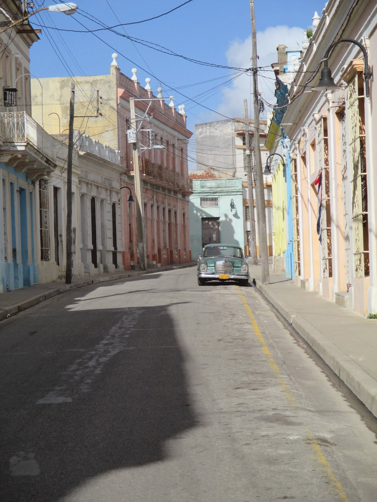
Street in Camaguey
Camaguey – Trinidad, we hired a taxi.  Initially we were quoted a price of 150CUC, but settled on 135CUC.  We probably could have gotten a lower price.  We ended up in a well-taken care of Lada (with good shocks) – it took us 3.5 hours, and the driver helped us find a casa in Trinidad.
Trinidad – Cayo Guillermo, we hired a taxi again (the husband of our casa owner) and paid 130CUC for the ride, taking about 4 hours.

From Cayo Guillermo, we took a airline shuttle bus (10CUC each) to the airport at Cayo Coco and flew to Toronto.

Lodging

The first night we were booked into a high-end hotel.  While it was ok, it felt a little remote from "the real Cuba" - it was basically the city equivalent of the beach resorts.  It didn't help that it was 6km west of the city centre in Miramar.  However, it was just for the one night, and the next day we headed into Havana Vieja to the casa particular that we had booked.

After that we stayed in casas the entire way.  We pre-booked our Havana casa via havanacasaparticular.com, which we found recommended on LonelyPlanet's ThornTree.  Our reservation wasn’t passed on to the owner, though, so she had no idea we were arriving (and had rented out the room.)  Lesson:  Always call in advance!  She helped us find another casa in the neighbourhood, only three blocks away. We paid 30CUC/night plus 5CUC for breakfast.  The casa was new, clean, and had an air conditioner, ensuite bathroom, sheets, towels and soap.

We also pre-booked our Baracoa casa through mycasaparticular.com.  We called and confirmed a few days in advance, and they had a taxi driver meet us at the airport.  We paid 25CUC/night plus 4CUC for breakfast.  The casa was incredible - there was a rooftop terrace, where we could sit back and relax, as well as another terrace on the second floor, this one offered a bit more shade and protection from the elements if it happened to be raining.  This is also where we were served breakfast.  Again, the room came equipped with an ensuite bathroom, sheets, towels (no soap), a/c and a fan.  There was also a maid, who did our laundry for us.
 
Looking out at Baracoa
Our Baracoa casa owner booked a Santiago casa for us, and again we were met at the Viazul station.  We paid 25CUC a night, and 3CUC for breakfast.  This casa was a little different - the bedroom and ensuite bathroom had at one point been one room, but it was partitioned, and a false ceiling installed in the bathroom.  The partitioning wall had a "window" cut out up top, which looked out over the false ceiling in the bathroom.  The original end wall (now the end wall of the bathroom) had a tiny window up top.  The window cut out in the partitioning wall allowed our room some bit of sunlight during the day.  Despite this, the room was very comfortable - it had been painted with an outdoors sea mural, making the room feel a bit more expansive.

Santiago near sunset
We tried, in our stumbling Spanish, to see if our Santiago casa owner had a recommendation for a casa in Camaguey, but a miscommunication occurred, and we arrived with no casa booked.  We relied on a bici-taxi driver to find us one – he tried two before he found one with a room available.  Again we paid 25CUC a night, and 4CUC for breakfast.  Like all the other casas, we had an ensuite bathroom, towels, sheets and a/c.  

Our taxi driver from Camaguey found us a casa in Trinidad by knocking on doors.  We ended up in a nice casa in the historical centre, for 25CUC a night and 5CUC for breakfast.  As all the rest, we had to walk into the family home, but unlike  most of them, rather than walk all the way through their house to our rooms at the back, we had a staircase right near the door that led up to area that had the private rooms for rent.  

Only in Havana and Baracoa did the casa owners speak some English, the rest of the time it was strictly Spanish.  All casas had towels, ensuite bathrooms and a/c, but only a couple had fans.  Most also had water for sale.

Money

Definitely bring cash.  We carried some with us, and hid some in our rooms.  We didn't have a problem with pickpockets, but that's not to say that you shouldn't take precautions.   Most places (restaurants, paladars, casas, etc.) don't take credit or debit cards.  (It wasn't until we got to the resort that we actually used one.)  If you do find you need some extra money, we did find working ATMs in Santiago and Trinidad.  We saw one in Havana that wasn't working, but I'm sure there are others.  

Street performs in a square in Havana

Food

Cuban food gets somewhat of a bad rap.  If you've travelled in Central America, you'll be familiar with the "beans and rice" theme.  You'll also be familiar with the "no seasoning" theme.  We did find most meat to be over-cooked, and over-salted, but otherwise the food is very straight-forward.  A little bland, but certainly not bad.
While we don’t have any food allergies, I don’t eat seafood or eggs, which wasn’t hard to deal with in Cuba, although breakfast was usually fruit, bread and eggs, with the occasional side of ham and cheese. 

We ate mostly at paladars in Havana – when we decided we were hungry and it was time for lunch/dinner, we’d head out to the streets and were usually approached by someone with a menu.  If the prices/options looked decent, we’d go to the restaurant and if that looked decent, we’d eat there.
In Baracoa and Trinidad we just wandered around until we found a paladar or restaurant that looked good.  We ate the old fort in Baracoa – the food was good, and we were out of the eye of most jinteros.  In Santiago we ate at the Gran Hotel – just for a change of pace.  In Camaguey, we went to a few recommendations from LP – they turned out ok.  We especially liked the Italian restaurant in Camaguey, but found the buffet served at the Gran Hotel a little over-priced.  (It was 20CUC)

We ended up with food poisoning our third day in Havana – having said that, it can happen anywhere, even at restaurants at home.  Bring some Imodium (or similar) from home, as well as some soft toilet paper!, and drink plenty of fluids if it happens to you. 

Patio in Trinidad
For people with gluten allergies – everything came with bread, however most meals were served without a sauce of any kind, making it easier to avoid gluten (i.e. meats were seasoned with onion and garlic, no sauce.)  Still, small lunch spots tend to serve some variation on ham-and-cheese sandwiches so a bit more planning may be required.

For egg allergies – I had an easy time (mostly) of avoiding eggs, until I ordered a “club sandwich” at Sloppy Joe’s in Havana, and it came with an egg.  Most breakfasts included eggs of some kind, but the phrase "no komo huevos" lets them know that you don't eat eggs.  (However, they seemed to think I meant I didn't want eggs (no quiero huevos) so each morning they'd ask if I wanted eggs).

Fish was mostly easy to avoid, barring a few soups and rice that used a fish stock, however for vegetarians it may be harder.  We didn’t get many vegetables on our trip (lots of fruit, fewer vegetables) and most rice had a faint pork flavour.  The vegetable soups we ate also used a meat stock.  Our resort had lots of vegetable options, however.

Jineteros (touts, hustlers, etc)

Having been to East Africa and some other countries in Latin America, we didn’t find Cuba to be too bad in terms of street touts.  We used them to find paladars, but ultimately it was our decision to stay and eat or go.  We did find them to be a bit of a hassle around Hotel Inglaterra – we were sitting on the patio having a drink and it was (at first) a non-stop barrage of people asking for money or trying to sell you things. We used the same technique we have elsewhere – we ignored them, unless they came right up to our table, at which point we said ‘Non, gracias’ and then ignored them.  Havana was the worst; Trinidad, Baracoa and Camaguey we were hardly bothered.

If you’re doing a city tour from one of the resorts, you’re more likely to be targeted – we did, and that little plastic bracelet was like a magnet.  Again, we were polite by firm and ended up being left alone.

Excursions
For the most part, we spent our time wandering around the different cities - no plan, no goal, other than to see and find what we could.  This worked well in Havana (until we tried to do the LonelyPlanet walking tour, at which point we got thoroughly lost), Camaguey and Trinidad.  

Farmer's hut in AvHNP
In Baracoa, we booked a hike in the Alexander van Humboldt National Park, through Cubatur.  We left around 9:00 a.m. and drove to the Park.  From there, it's a 3 - 4 hour hike into the rain forest, passing a few small farms along the way.  The guide stopped often to give us information the flora and fauna of the region, pointing out different birds, lizards, frogs/toads, flowers and trees.  The going was slippery, especially once we hit the rain forest section, and most everyone ended up with some red mud caked to their pants, having slipped.  

Just after 1:00, we came to a small clearing, beside a little pond/river and waterfall.  We all changed into swimsuits, and took to the water.  After the hike, it was wonderfully refreshing.

Which brings me to shoes.  If you have a pair of Teva-like sandals (with straps over the foot, and around the ankle) they are by far the best type of footwear for this hike.  There are quite a few river crossings, and if you're in boots/runners, you'll be forever taking them off/putting them on.  Not to mention that at the waterfall, there were a lot of rocks to cross before getting to water deep enough to swim in.  Towards the end of the hike, the BF and I decided to just tramp through the water with our shoes on.  (This led to having to buy new shoes in Trinidad, because ours smelled so bad.  They'd be stuck in a plastic bag for nearly a week, since we didn't have a balcony/terrace in Santiago or Camaguey to set them out in the sun.)

Souvenirs
Everything was a repeat.  If you saw wooden toys in one city, you'd see them in every city.  The only exception to this was artwork.  We saw a lot of beautiful artwork in Havana, and even considered buying a small picture, but ultimately decided against it, as we were in the beginning of our trip.  We never did find anything of remotely the same talent in the rest of Cuba.
The Resort
Ocean view from our room
We chose to stay at Sol Cayo Guillermo.  Cayo Guillermo, and Cayo Coco, are connected to the main island via a causeway.  There are no Cubans that live on there - it's purely for tourists, and Cubans need to have a special permit to access the causeway.  It is very much not "Cuba."
The resort was 4-star, but still very nice.  Clean, comfortable and the staff were great.  There were a lot of mosquitoes and other biting insects (I ended up with over 80 bites on my legs); the resort did fumigate nightly, but I'm not sure it helped.

 I found the feeding schedule really restrictive - the snack bar was open from 11 a.m. to 6 p.m., but it served greasy, fried food - hamburgers, hot dogs, grilled sandwiches, chips, etc.  And there was nothing available between when breakfast ended (10 a.m.) and when the snack bar opened.  Which of course, is when I would get hungry.  The buffet was wonderful - a huge array of food, and lots of options.  There was also a huge salad bar - with lettuce!  I was so excited to have a salad, after two weeks of no veggies.

White sand beach
The beach had beautiful white sand, ruined by a lot of seaweed.  I think it was just a bad time for seaweed, and they did try to keep it somewhat under control.  The water was wonderfully warm, and very shallow for quite a ways out.  

We did a few excursions from the resort - we took a trip to Moron and Ciego de Avila, which probably would have been better if we hadn't done Cuba on our own first.  You're only given 30 - 45 minutes of "free time" in each city, and the "tour" they give you doesn't give you much of an idea of the cities themselves.  However, the speed boat trip across a lake, and into a mangrove forest was incredible, and the crocodile farm was interesting, and interactive.  For a fee, you can hold baby crocodiles and iguanas, and feed the adult crocs.

Ah, hugs!
Our second excursion was to the dolphinarium on Cayo Guillermo.  It was expensive, 110CUC each, but we got to swim with trained dolphins.  We interacted with them on the dock for a bit, then jumped into the water.  One by one, we got to go up and perform some tricks with the dolphins, before posing for pictures.  Afterwards, we headed to Playa Pilar for lunch, and some relaxing time on the beach.


TL;DR version

Pros                                                                               Cons
- Trinidad and Baracoa                                                   - Santiago and Havana (after 3 days)
- inexpensive destination                                                - repetitive food and souvenirs
- Viazul buses north to south                                          - Viazul buses south to north